REMEMBERING LBI… The Way We Were
Hi, and welcome. I expect to be adding more to this page. I hope to share some of my memories of LBI from long ago. I was born with bay mud between my toes and pine needles in my hair and my first visit to LBI was in 1938 (before just about anyone reading this was born!) and most weekends and vacations as I was growing up were spent at West Creek, where I was born. My dad at the time was a bayman and worked on an oyster barge as engineer; they lived on Joe Cox’s farm, and he and my grandad had gill nets across the creeks for fish, they clammed and captured terrapins, and anything else the bay provided — most of which were sold in Moorestown, NJ.
I met my wife when she was working at Nanni’s Pizza in Beach Haven and after we got married we continued to visit the homestead in West Creek until we sold it in 1998. Our sons grew up loving the woods and the water.
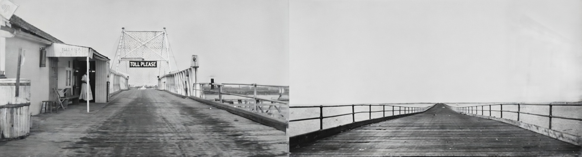
It’s hard to believe but in 1918 they charged a toll for that old nail-popping drawbridge, and now it is free!
How Did They Turn the Trains Around on LBI?
I remember the railroad bridge just to the north of the causeway bridge. I used to wonder how they turned the trains around without a turntable. I now know that they used a wye at Beach Haven. I would imagine the train heading south would stop at the station and discharge its passengers, then back into the southern leg of the wye and exit the northern leg and head on north. The top of the wye is now the end of 5th Street.
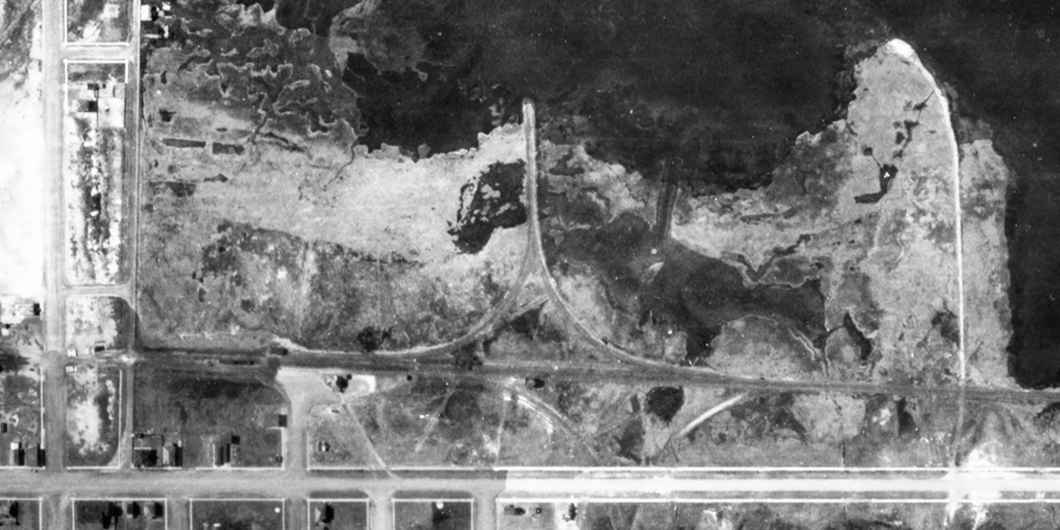
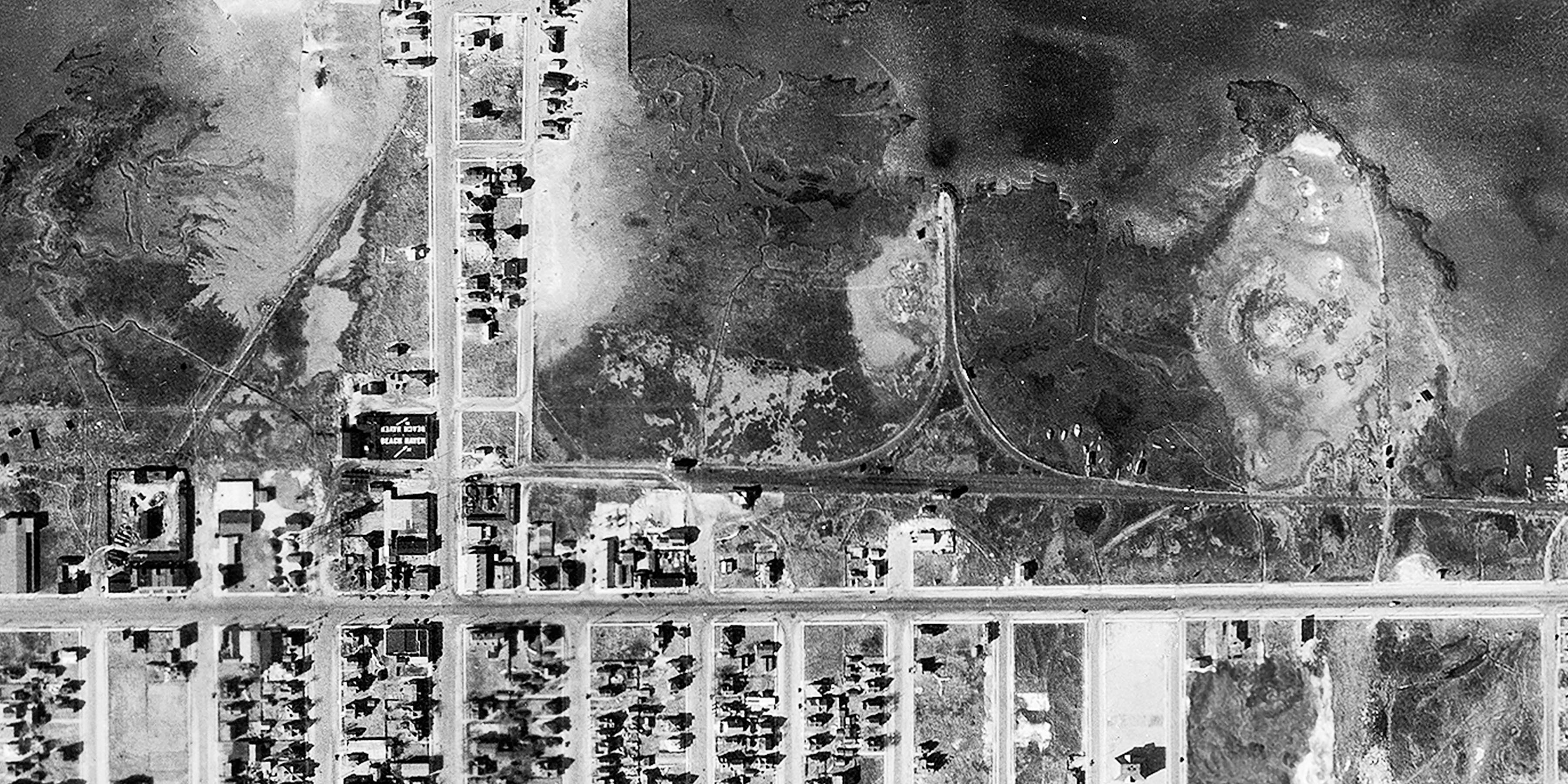
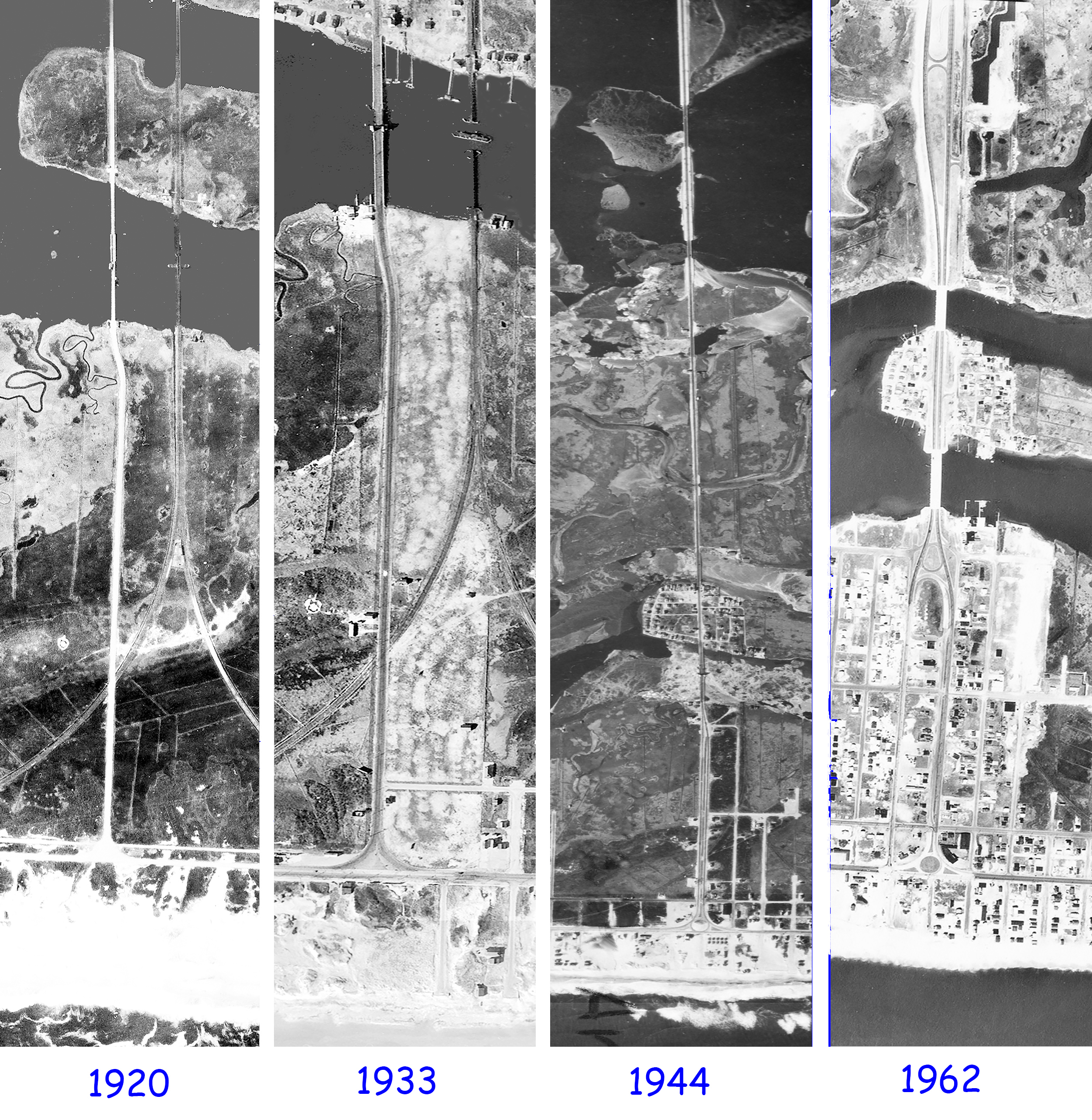
The Evolution of the Causeway
Beach Haven’s Boardwalk — Before and After the Hurricane of 1944
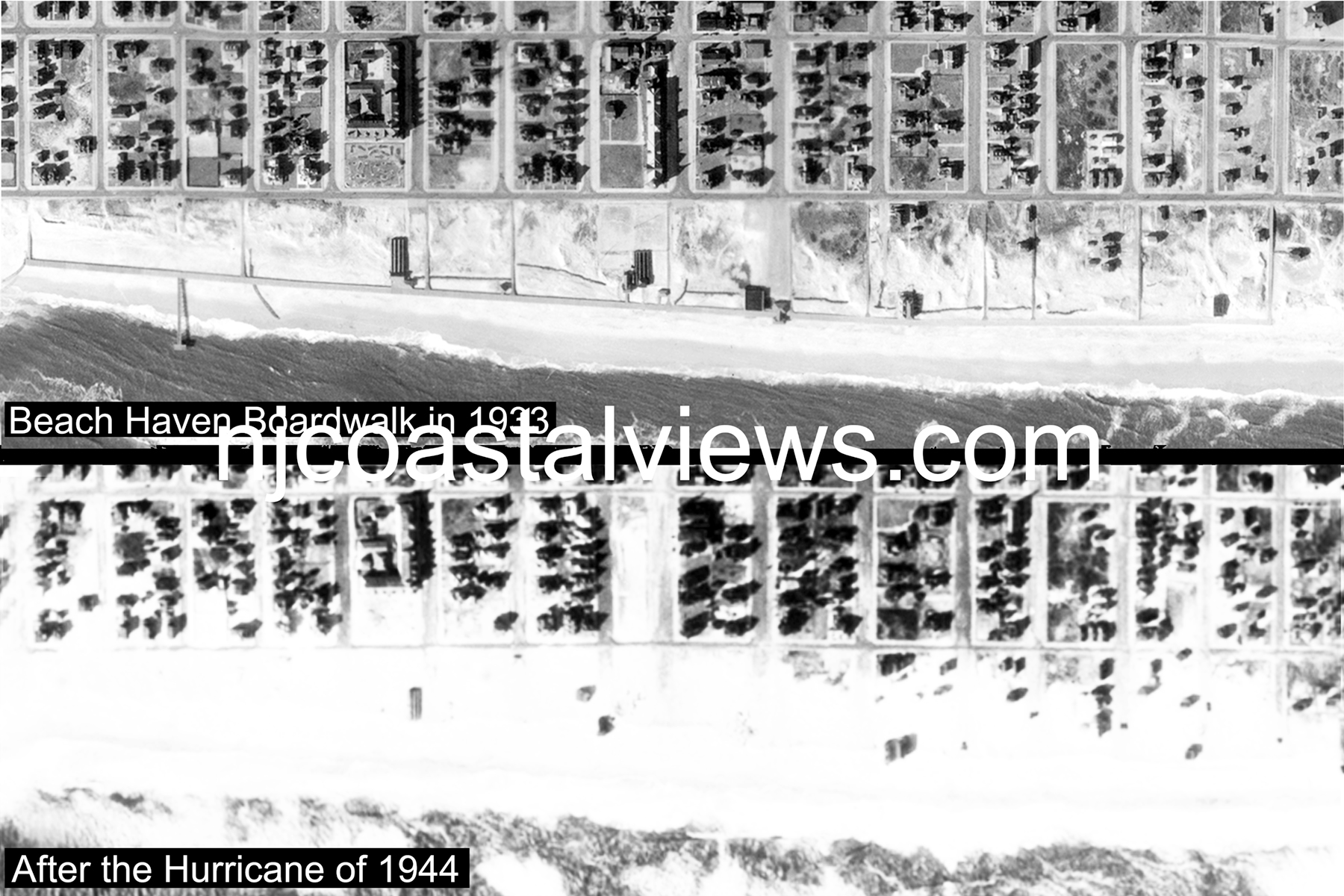
Beach Haven once had a nice boardwalk with several shops and a fishing pier complete with a bait shop. It was totally destroyed in the hurricane of 1944.
LBI Prints For Sale
I have aerial views of the entire NJ coast beginning with 1920, then 1933, 1944 and 1962, which were stitched together to create some awesome views of the old days. Listed below are the views I have of LBI.
Prints are available in three sizes: 11”×14” Matted ($20), 11”×17” Framed ($30), and 13”×19” Framed ($35). Custom sizes available — contact us!
LBI Towns
Mainland Towns (1962 Only)
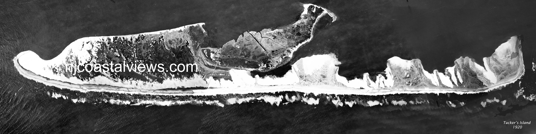
Also available on the Tucker’s Island page. Custom sizes — contact us.
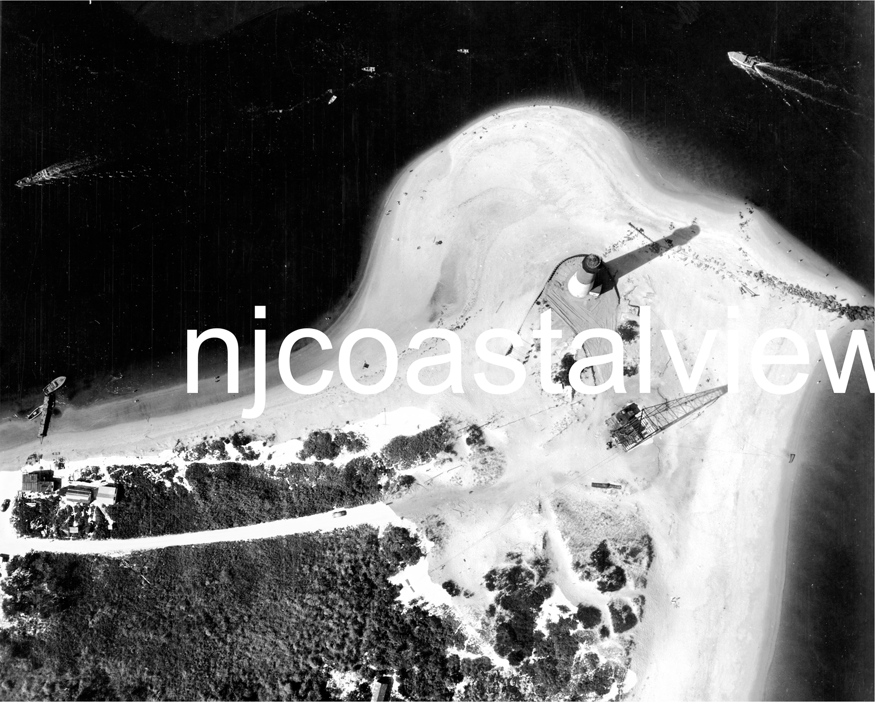
Taken from a blimp just after the hurricane of 1944 — a uniquely rare aerial perspective.
Also available on the Barnegat Light page. Custom sizes — contact us.