Low resolution samples — prints are significantly sharper and more detailed.
The Dunes — LBI's Natural Landscape Against the Development Tide
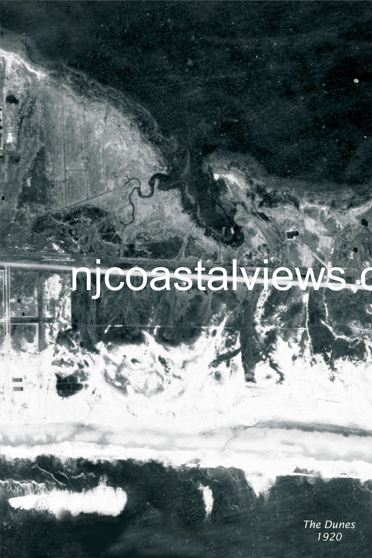
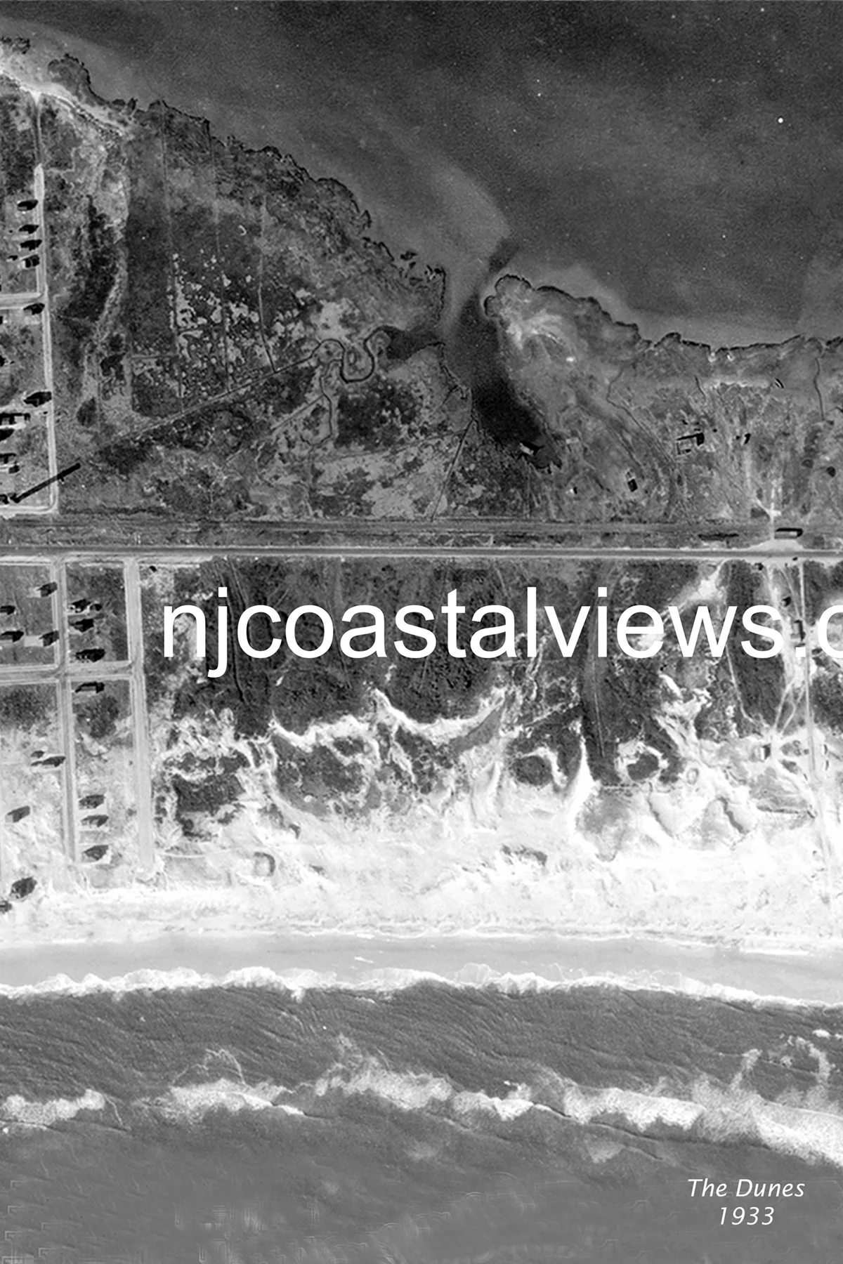
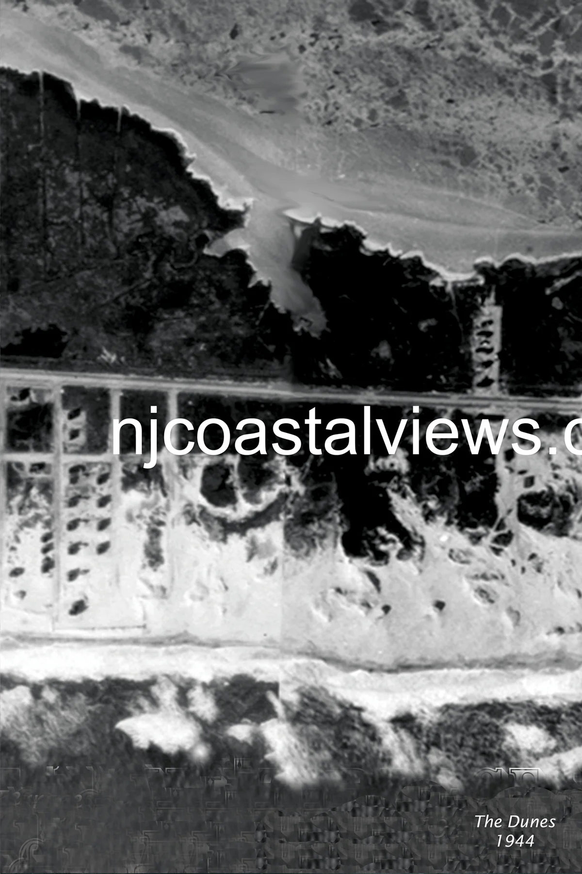
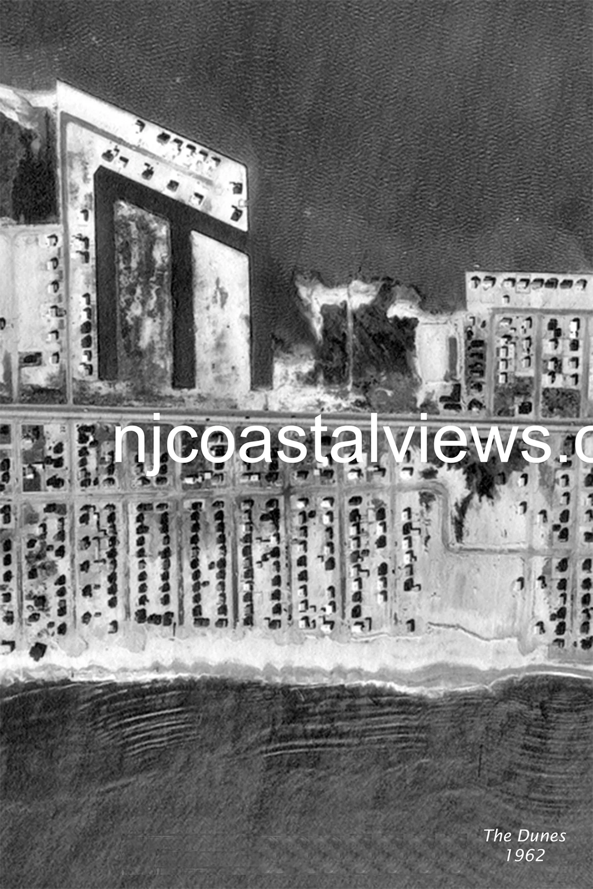
The name says it all — this section of LBI was defined by the dune topography that once covered the entire island. The 1920 aerial shows exactly that: a landscape of natural dunes behind a broad beach, with minimal development interrupting the natural sand terrain. By 1933, cottages had appeared but the dune system was still largely intact. The 1944 Great Atlantic Hurricane stripped significant sections of the frontal dune — a visible benchmark of natural change. By 1962, The Dunes was a developed community, but the remnant dune topography is still visible in the aerial — a reminder of what the entire island looked like in 1920, before decades of building replaced it.
Order Prints
Available in three sizes: 11×14″ Matted ($20) • 11×17″ Framed ($30) • 13×19″ Framed ($35)