Low resolution samples — prints are significantly sharper and more detailed.
Harvey Cedars — Where the Island Is Widest
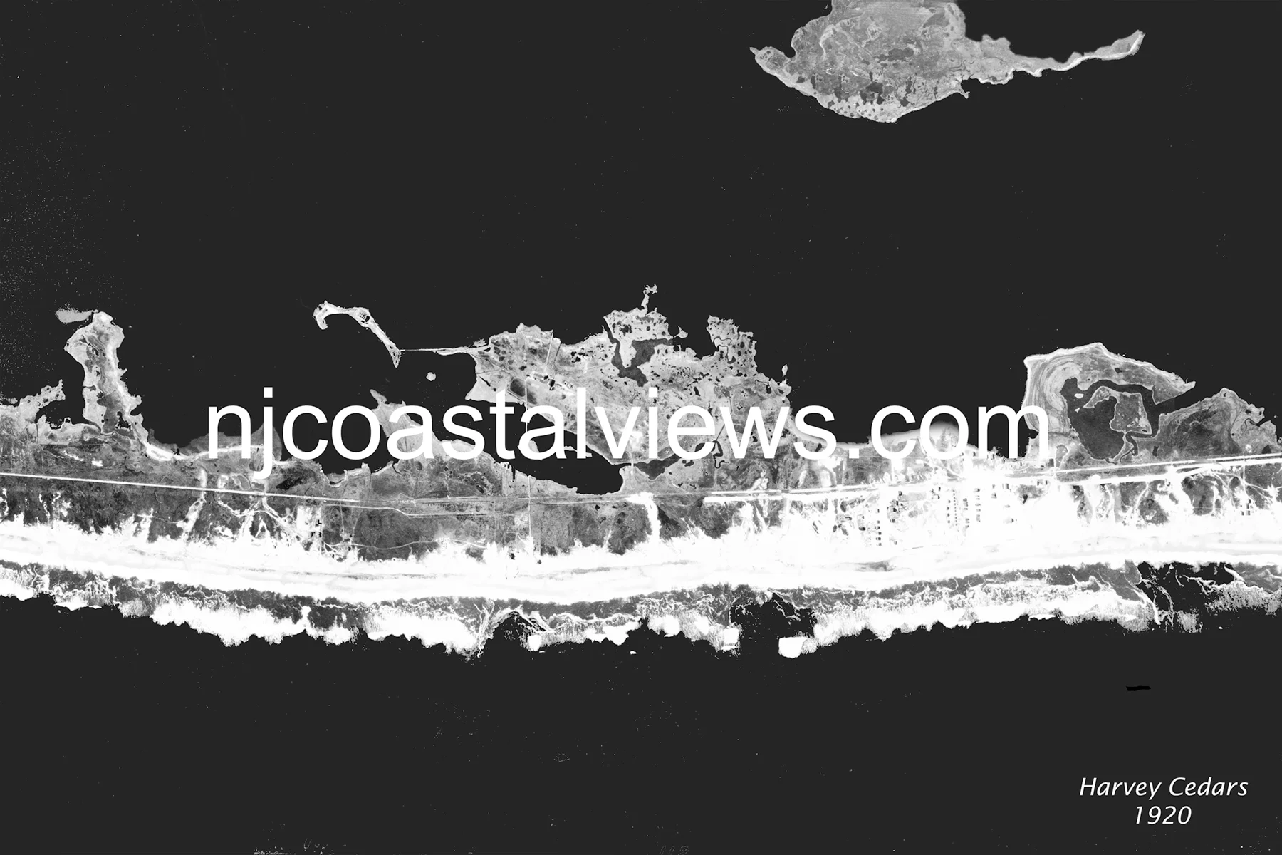
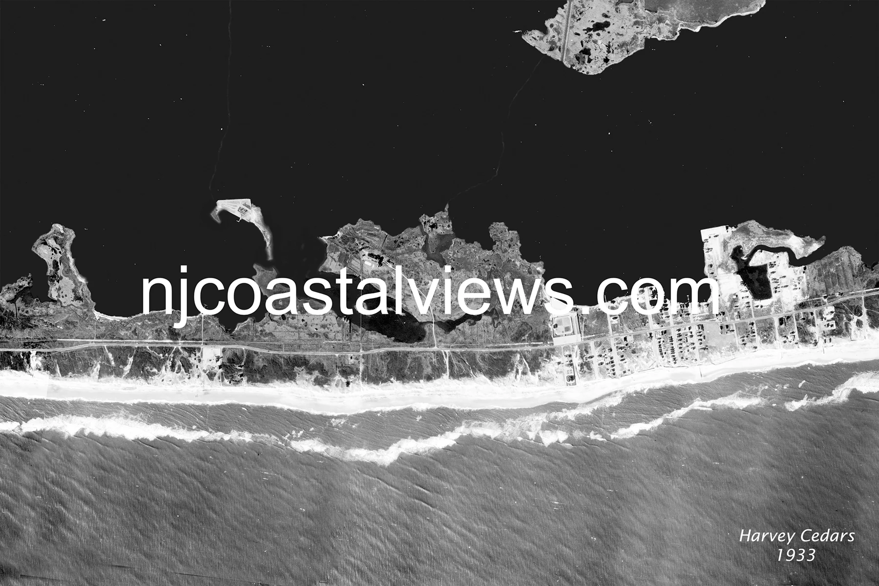
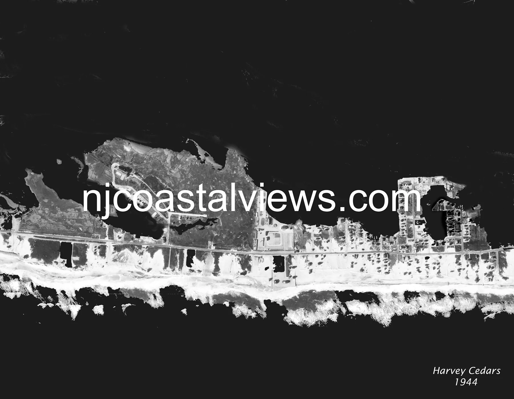
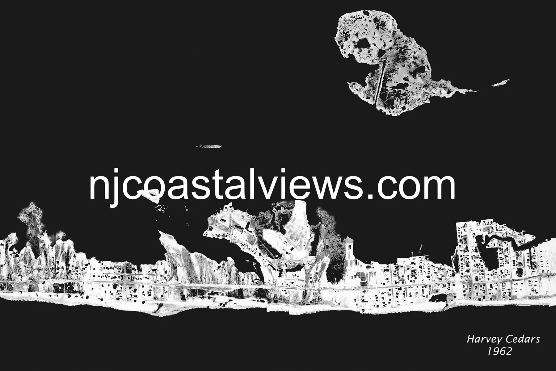
Harvey Cedars sits near the widest portion of Long Beach Island — and in the 1920 aerial, that width is evident: a generous sand beach on the ocean side, substantial cedar-covered dunes, and the bay to the west. The 1920 view shows the Harvey Cedars Bible Conference (established 1894) and a scattering of summer homes. By 1933, development had grown modestly. The 1944 Great Atlantic Hurricane pushed ocean water across the island at several low points, and the 1944 aerial captures the island's altered dune face. By 1962, Harvey Cedars was fully developed as a summer community — and the Ash Wednesday Storm tested it severely, driving surge from both sides simultaneously over three full tidal cycles.
Order Prints
Available in three sizes: 11×14″ Matted ($20) • 11×17″ Framed ($30) • 13×19″ Framed ($35)