Low resolution samples — prints are significantly sharper and more detailed.
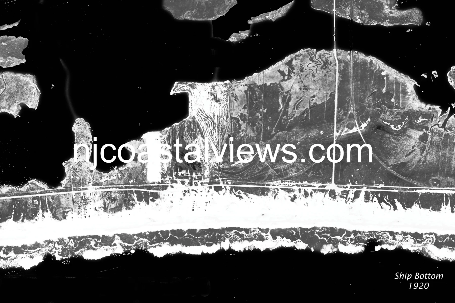
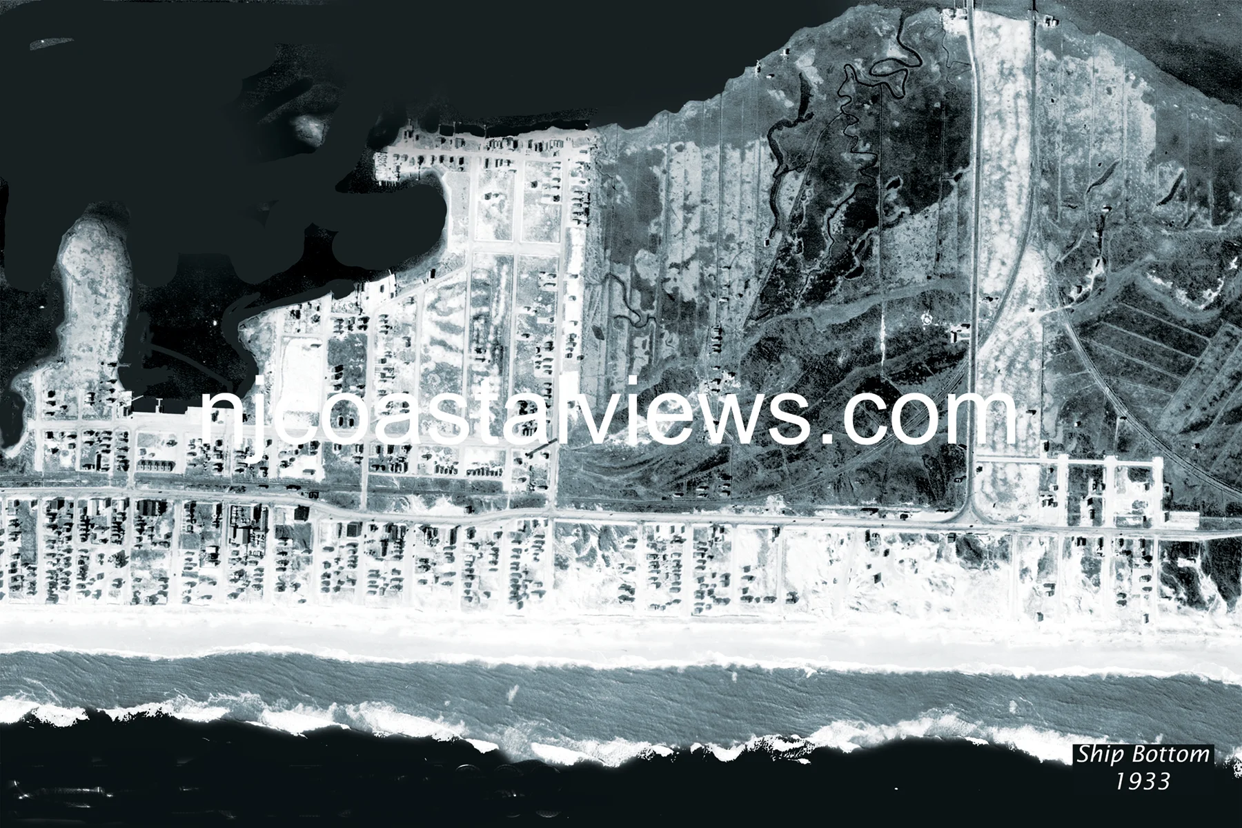
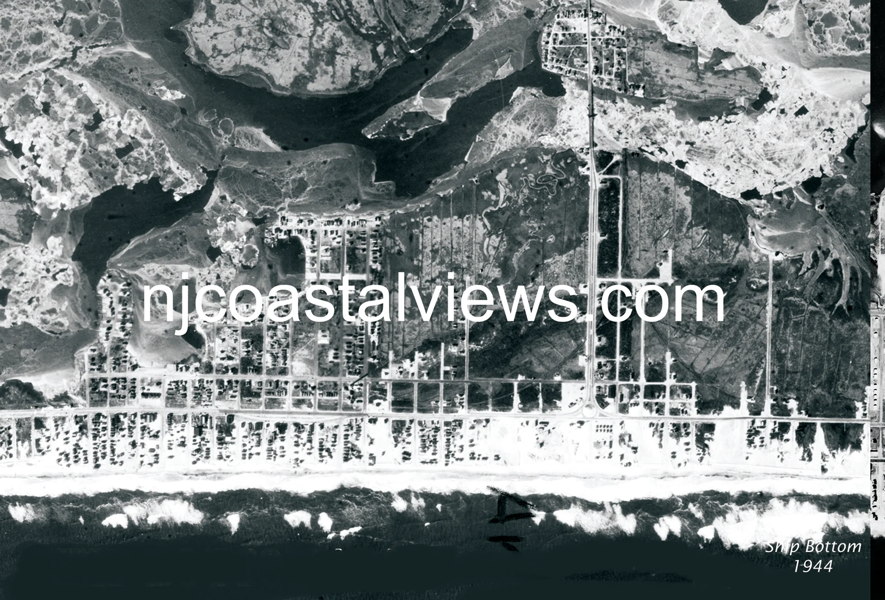
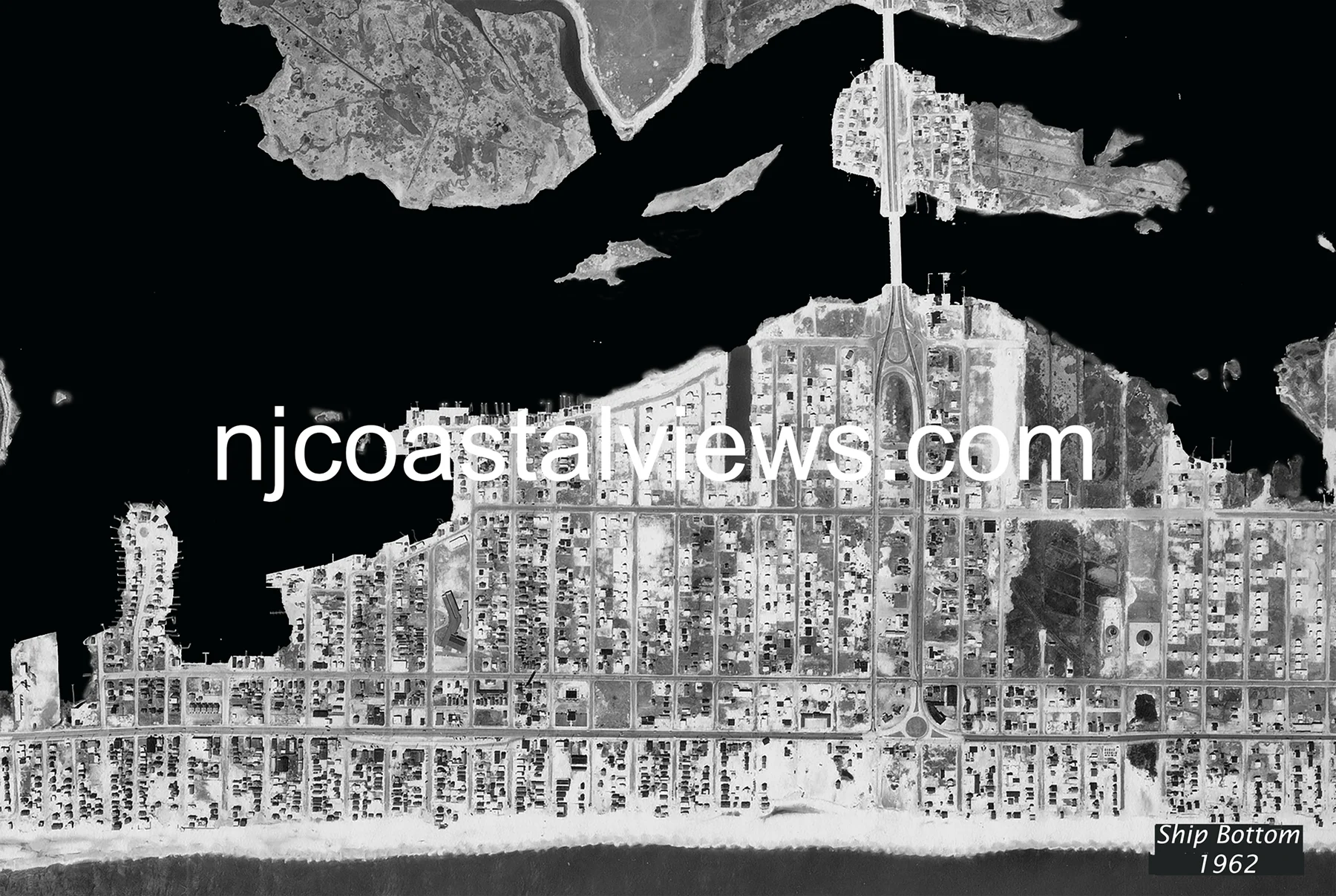
Ship Bottom — The Causeway Town
Ship Bottom takes its name from a 19th-century shipwreck and serves as LBI's mainland connection — the causeway from the mainland lands here. Ship Bottom is also one of the narrower points on LBI, making storm overwash a recurring threat. The 1920 aerial shows the community centered on this causeway access, with Long Beach Boulevard running north-south through the island. The 1933 hurricane flooded the low-lying areas near the bay. The 1944 Great Atlantic Hurricane struck Ship Bottom hard — compare the 1933 and 1944 aerials and the dune damage is clear. By 1962, Ship Bottom was a busy crossroads, and the Ash Wednesday Storm overwashed the island completely at its narrowest points.
Order Prints
Available in three sizes: 11×14″ Matted ($20) • 11×17″ Framed ($30) • 13×19″ Framed ($35)