Low resolution samples — prints are significantly sharper and more detailed.
Stone Harbor — Seven Mile Beach's Southern End
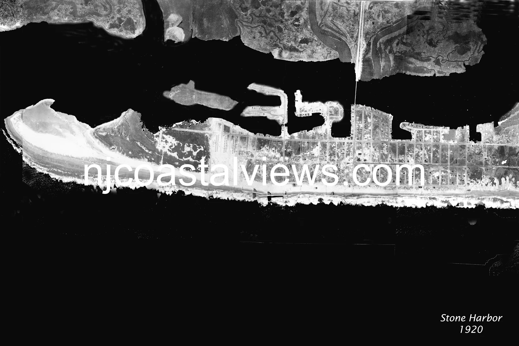
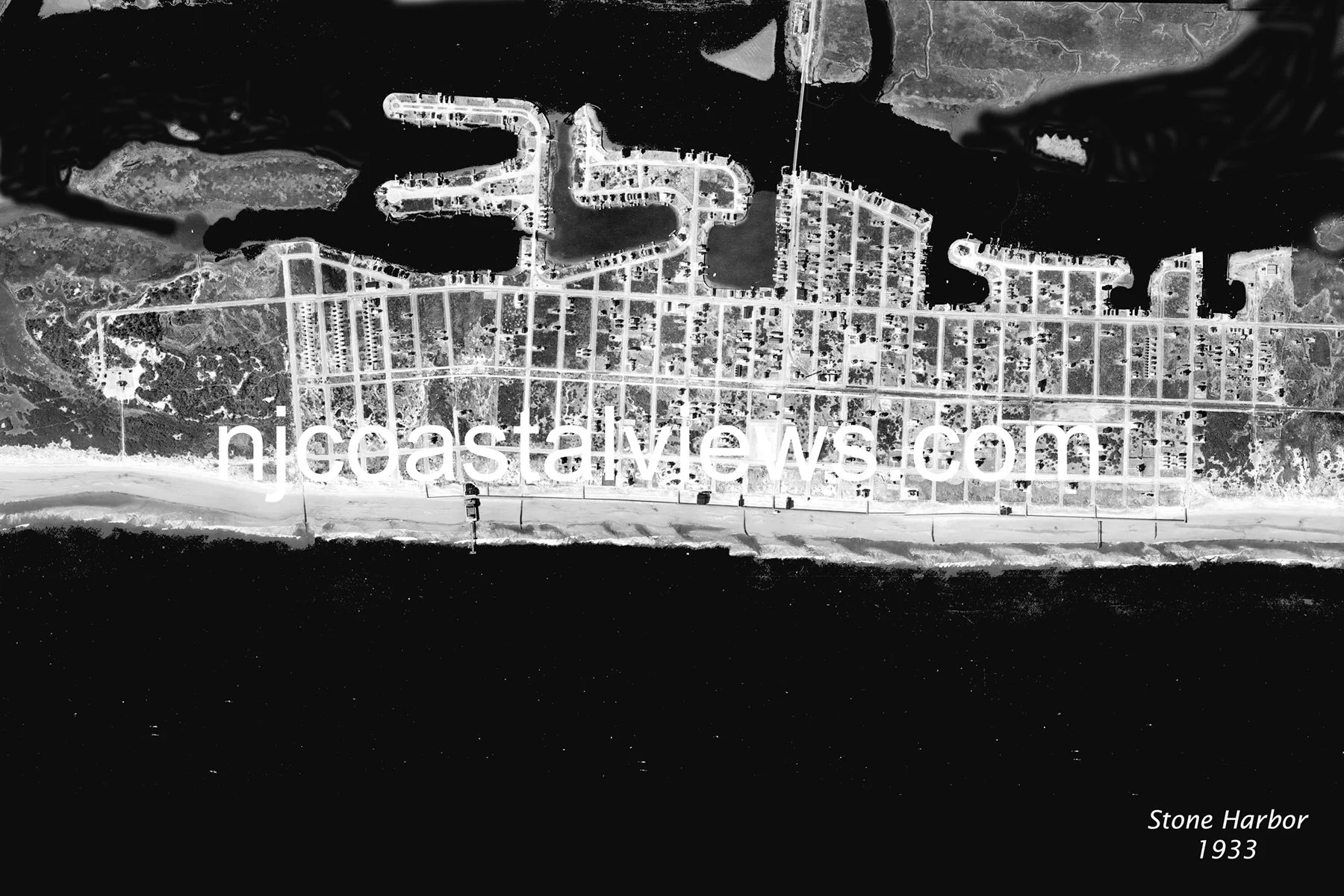
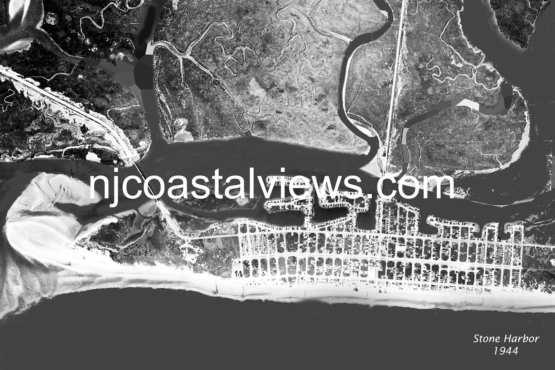
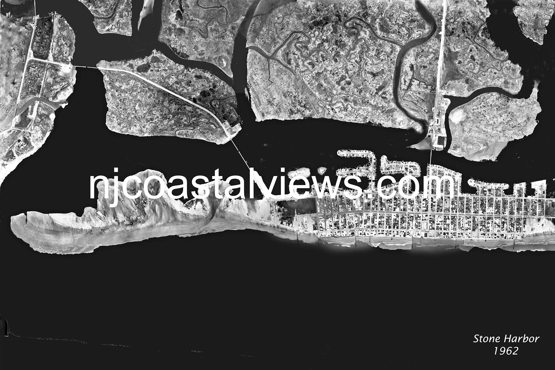
Stone Harbor occupies the southern half of Seven Mile Beach, with Hereford Inlet at its southern tip separating it from Five Mile Beach. The 1920 aerial shows Stone Harbor's orderly resort grid and a wide ocean beach, with the distinctive Hereford Inlet Lighthouse visible at the island's tip. By 1933, the summer hurricane had eroded the southern point of the island — the inlet area is particularly exposed. The 1944 Great Atlantic Hurricane caused further erosion at the southern tip. By 1962, the Ash Wednesday Storm added another chapter, and the 1962 aerial shows Stone Harbor's beach noticeably narrower than the generous strand visible in 1920.
Order Prints
Available in three sizes: 11×14″ Matted ($20) • 11×17″ Framed ($30) • 13×19″ Framed ($35)