Tweet
Share
Plus
Pin
REMEMBERING LBI...The way we were

How did they turn the trains around on LBI?
1920 |
1933 |
|---|---|
 |
 |
I remember the railroad bridge just to the north of the causeway bridge. I used to wonder how the turned the trains around without a turntable. I now know that that used a wye at Beach Haven. I would imagine the train heading south would stop at the station and discharge its passengers then back into the southern leg of the wye and exit the northern leg and head on north. They could also do the opposite and swing up the nothern leg and back into the station. The top of the wye is now the end of 5th Street. I don't know where they turned on the northern end of the island. So far my best guess is that they used the wye at the end of the causeway but that would mean they had to back one way or the other on the northern leg, but that doesn't seem to make sense. If anyone knows, I would like to hear from you.
The Evolution of the Causeway
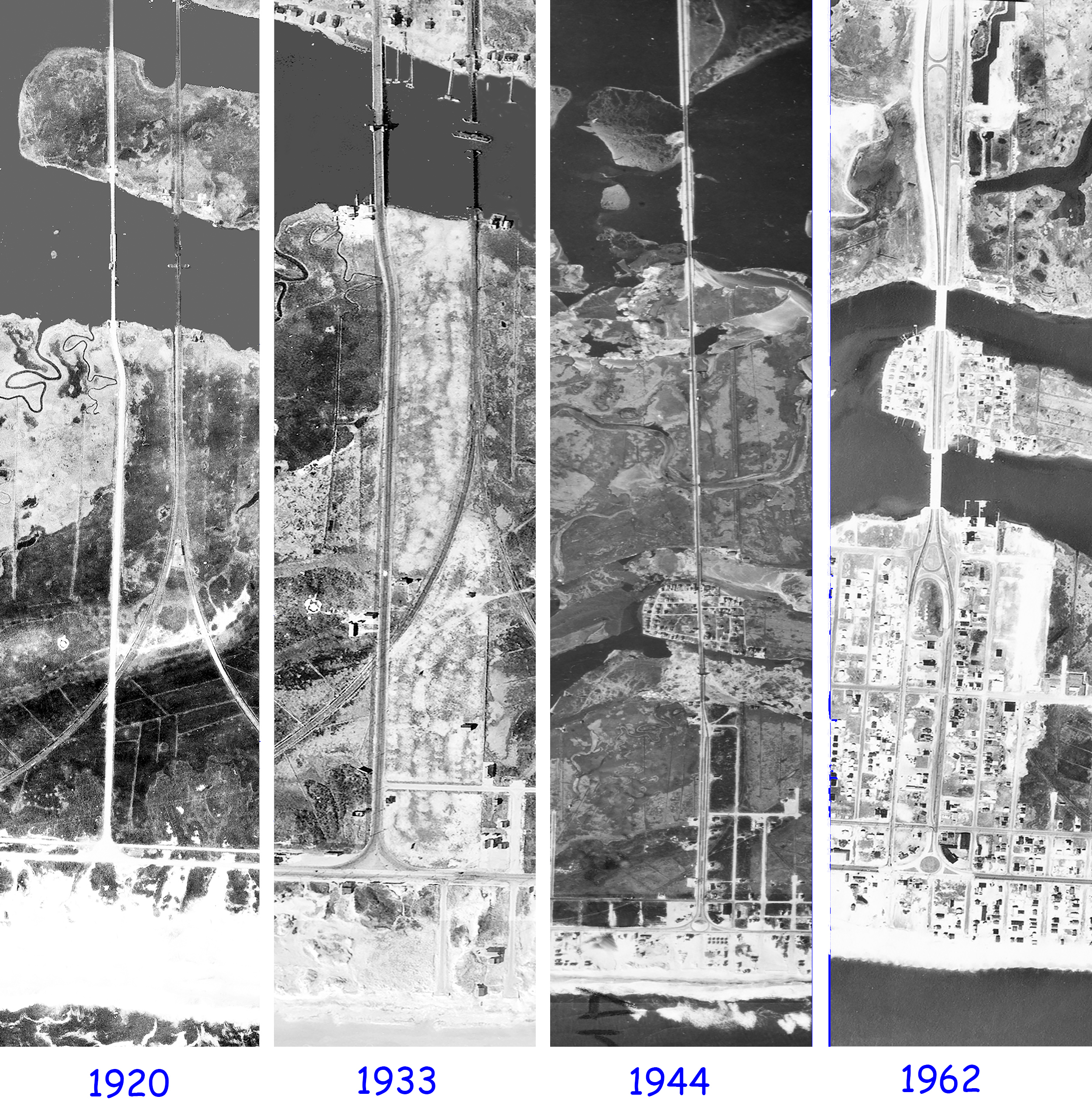
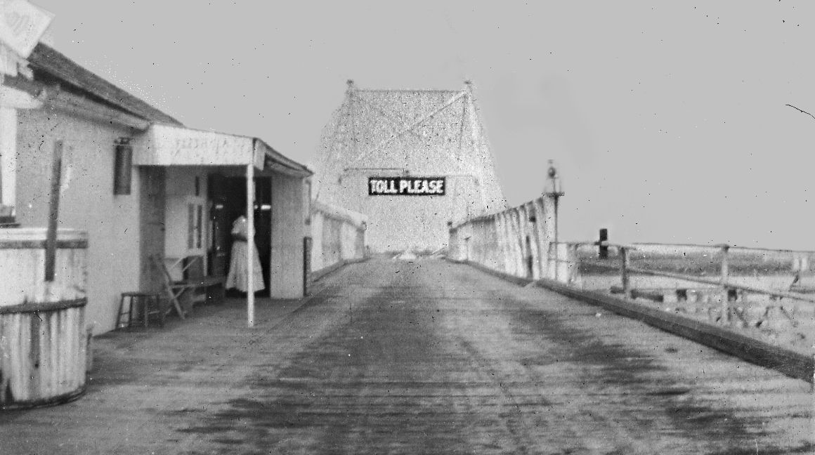
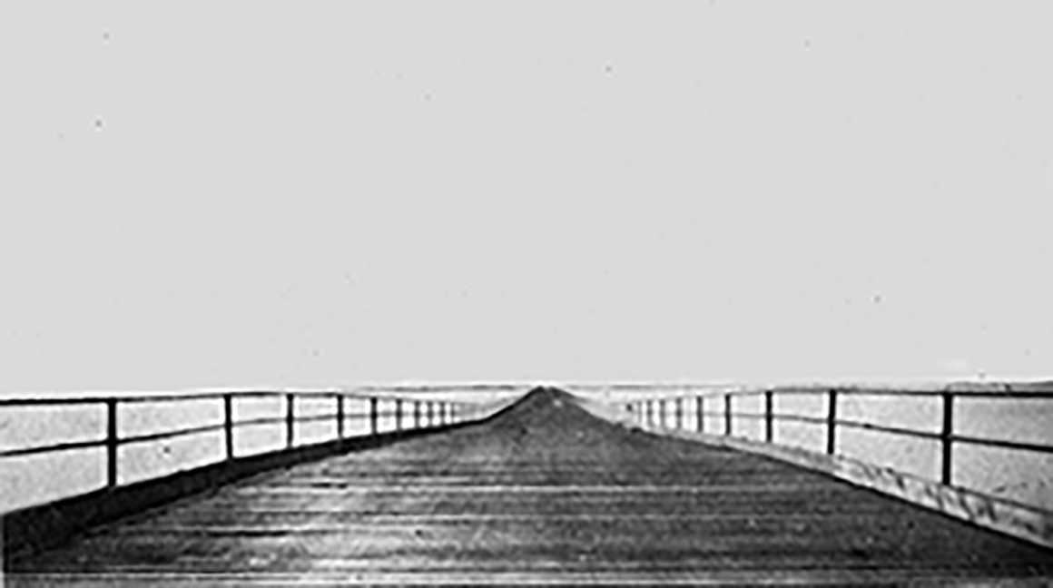
It's hard to believe but in 1918 they charged a toll (I wonder how much?) for that old nail popping drawbridge, and now it is free
LBI PRINTS FOR SALE
I have aerial views of the entire NJ coast
beginning with 1920, then 1933, 1944 and 1962, which were stitched together to create some awesome views of the old days, listed below are the views I have of LBI
If you choose to buy any of my prints, I think you will be as amazed as I was at the detail of the views. Several LBI businesses have some on display. I have two default styles, one is on Supreme gloss paper which is 11"x17", and photo paper which gives a bit more detail, and is done on a widebed printer. I list those at 12"x18" but they can be any size and customized any way you like. It is possible to create a set for the entire island, and if you are interested please contact me.
Please use contact us if you have a problem, or need custom prints such as zooms or different sized prints
LBI TOWNS
MAINLAND TOWNS
1962 Only
Barnegat Light | Beach Haven Park |
West Creek |
|
High Bar Harbor |
Haven Beach |
Parkertown |
|
Loveladies |
The Dunes |
Tuckerton |
|
Harvey Cedars |
Beach Haven Terrace |
Mystic Island |
|
North Beach |
Beach Haven Gardens |
||
Surf City |
Spray Beach |
||
Ship Bottom |
North Beach Haven |
||
Brant Beach |
Beach Haven |
||
Beach Haven Crest |
Holgate |
||
Brighton Beach |
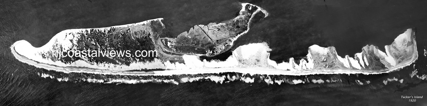
Tuckers Island |
||
Peahala Park |
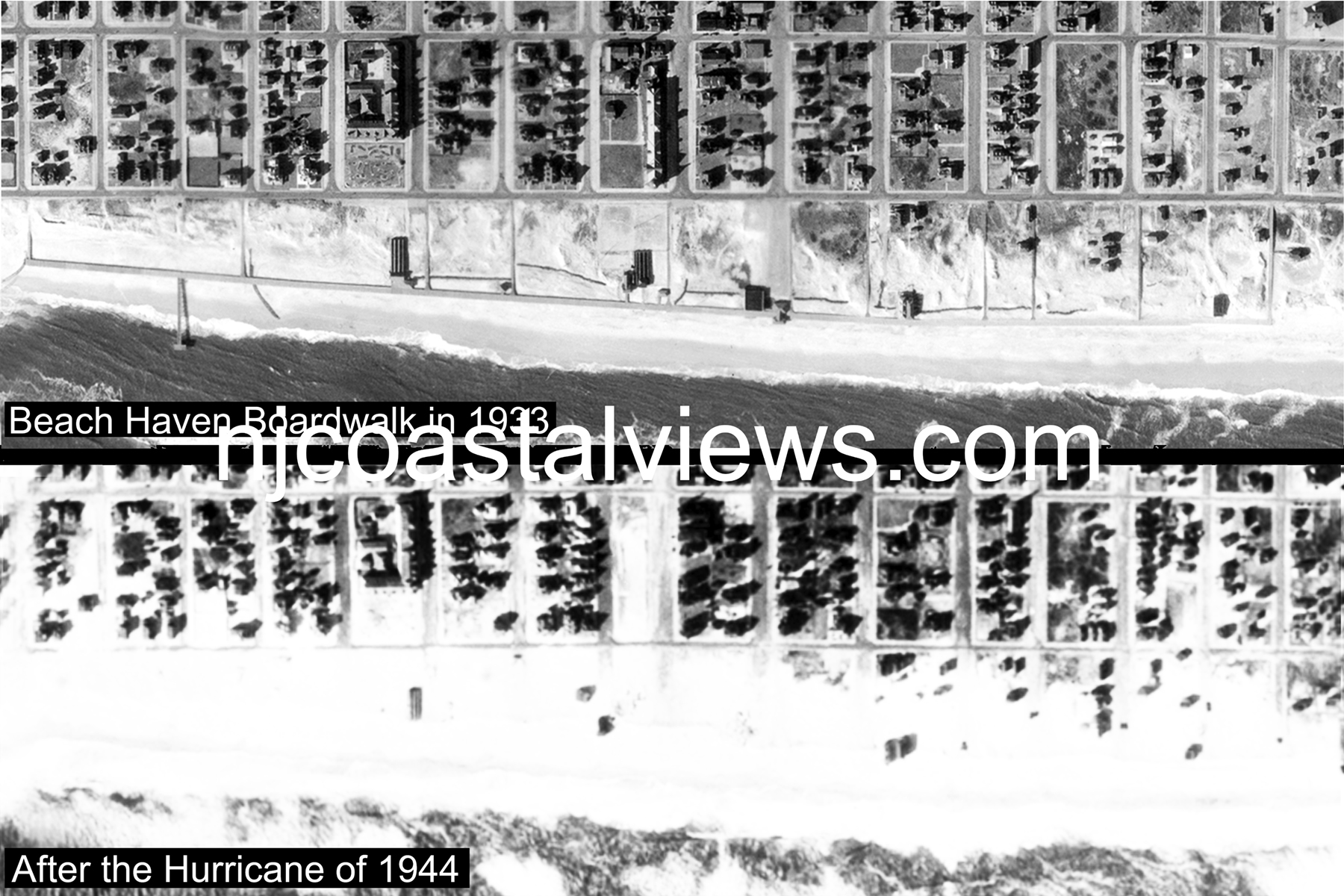
Beach Haven Boardwalk |
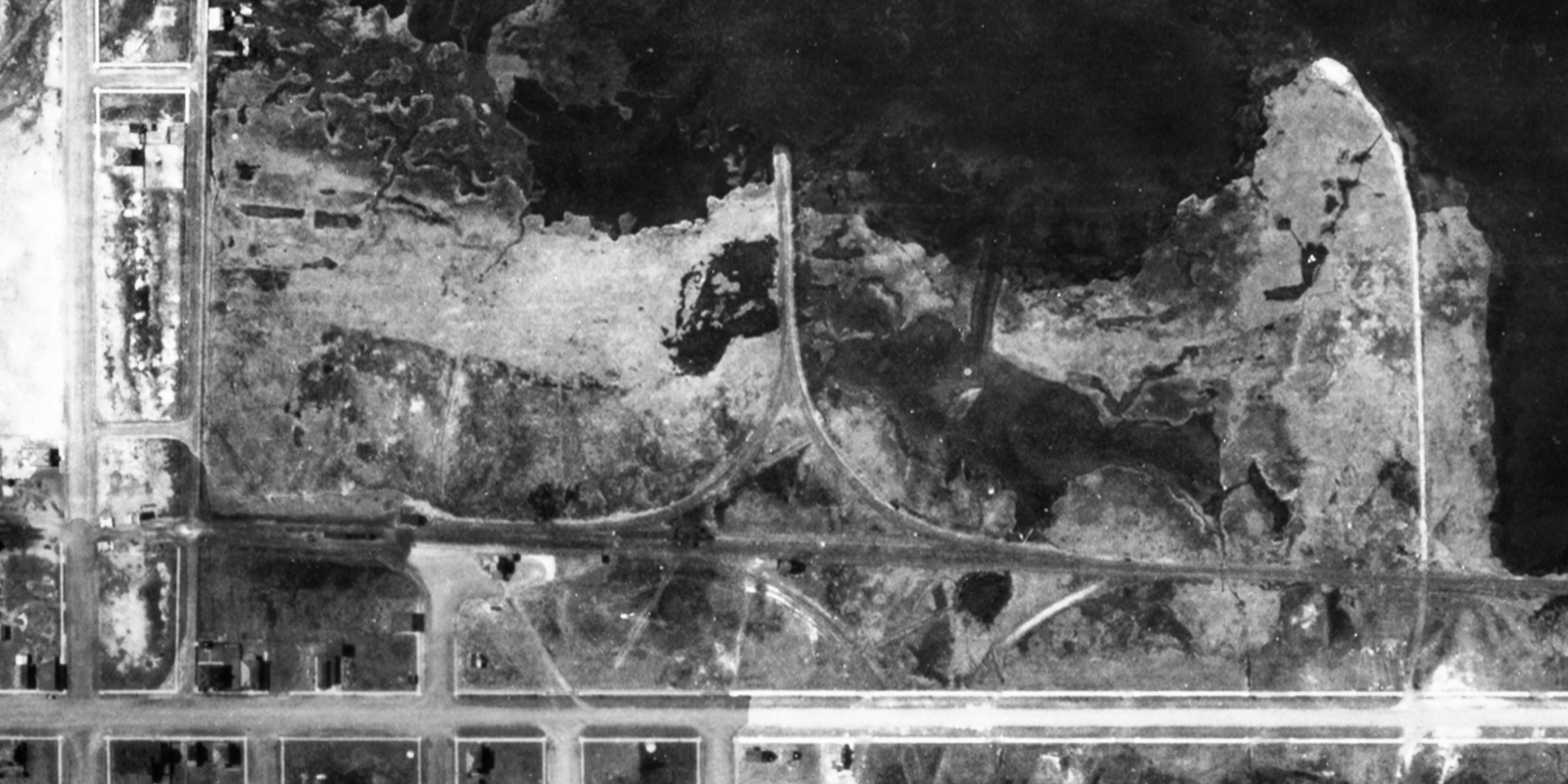
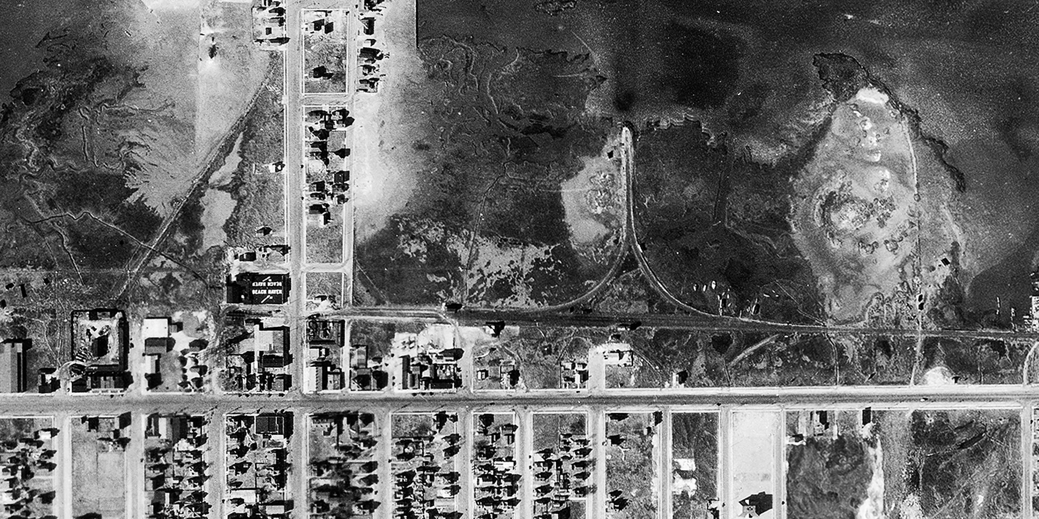
Tucker's Island 1920 |
Barnegat Lighthouse 1944 |
|---|---|---|
 |
 |
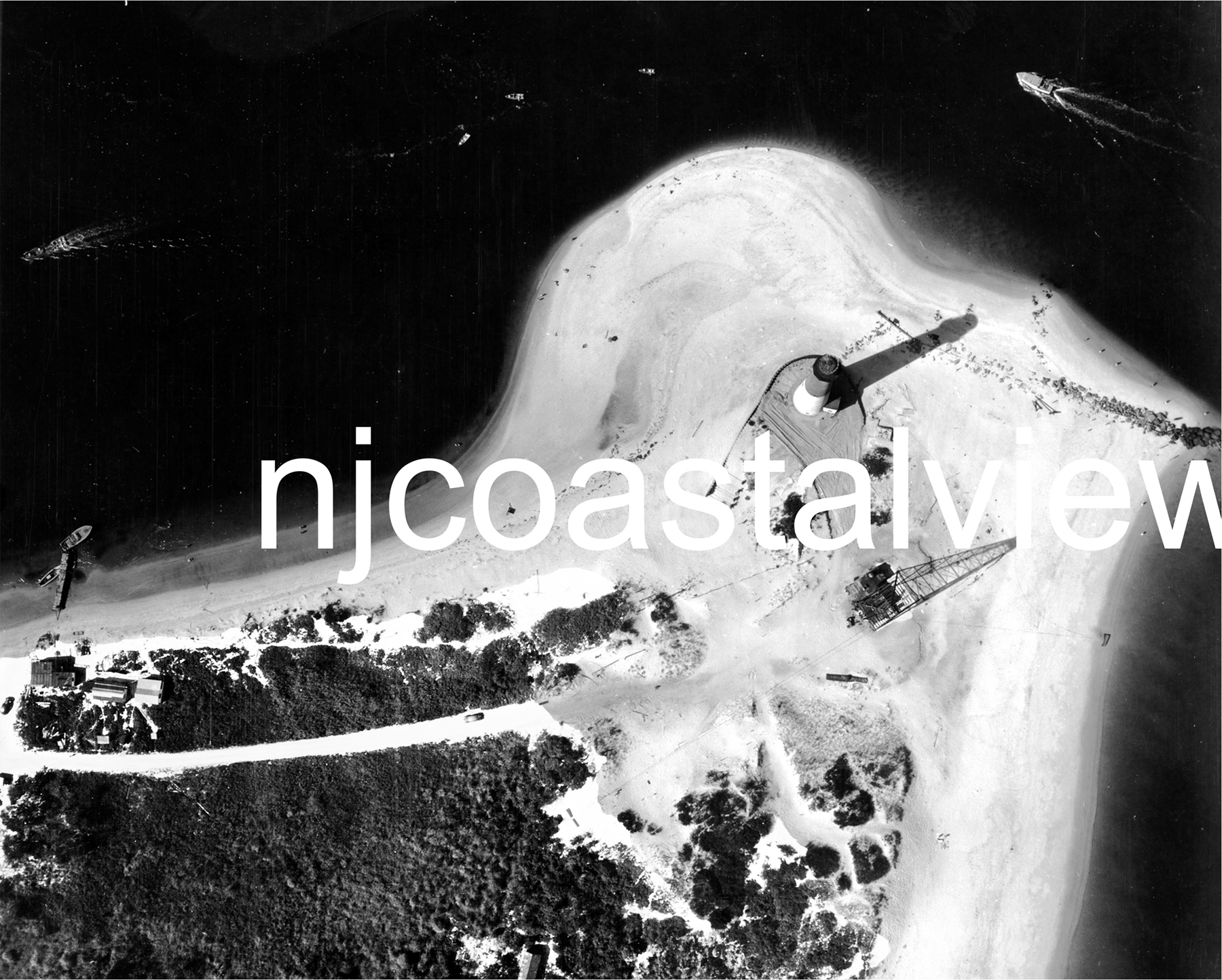 |
| Beach Haven once had a nice boardwalk with several shops and a fishing pier complete with a bait shop. It was totally destroyed in the hurricane of 1944. Supreme Gloss Paper 11x17"$15Photo Quality 12x18"$25 |
Tucker's Island is available in the standard 12x 18" print, but since it is so long and narrow, most of the print is taken up by black "ocean" but for anyone seriously interested, I also offer it in 12x48" which shows much more detail..Photo Quality 12x48"$70 |
This unique view was taken on Oct 29, 1944 by a blimp just after the huricane.Banegat Lighthouse 8x10"$10Matted for an 11x14 frame$20 |